


SCOTT - T 1 Voting District, Columbia County, Wisconsin
About
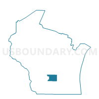
Outline

Summary
| Unique Area Identifier | 692889 |
| Name | SCOTT - T 1 Voting District |
| County | Columbia County |
| State | Wisconsin |
| Area (square miles) | 35.83 |
| Land Area (square miles) | 35.66 |
| Water Area (square miles) | 0.17 |
| % of Land Area | 99.53 |
| % of Water Area | 0.47 |
| Latitude of the Internal Point | 43.60523400 |
| Longtitude of the Internal Point | -89.18874720 |
Maps


Graphs
Select a template below for downloading or customizing gragh for SCOTT - T 1 Voting District, Columbia County, Wisconsin


Neighbors
Neighoring Voting District (by Name) Neighboring Voting District on the Map
- BUFFALO - T 2 Voting District, Marquette County, WI
- KINGSTON - T 1 Voting District, Green Lake County, WI
- MANCHESTER - T 1 Voting District, Green Lake County, WI
- MARCELLON - T 2 Voting District, Columbia County, WI
- RANDOLPH - T 1 Voting District, Columbia County, WI
- SPRINGVALE - T 1 Voting District, Columbia County, WI
- WYOCENA - T 3 Voting District, Columbia County, WI
Top 10 Neighboring County Subdivision (by Population) Neighboring County Subdivision on the Map
- Wyocena town, Columbia County, WI (1,666)
- Buffalo town, Marquette County, WI (1,221)
- Marcellon town, Columbia County, WI (1,102)
- Kingston town, Green Lake County, WI (1,064)
- Manchester town, Green Lake County, WI (1,022)
- Scott town, Columbia County, WI (905)
- Randolph town, Columbia County, WI (769)
- Springvale town, Columbia County, WI (520)
Top 10 Neighboring Unified School District (by Population) Neighboring Unified School District on the Map
- Pardeeville Area School District, WI (6,767)
- Markesan School District, WI (6,698)
- Cambria-Friesland School District, WI (2,323)
Top 10 Neighboring State Legislative District Lower Chamber (by Population) Neighboring State Legislative District Lower Chamber on the Map
- Assembly District 47, WI (61,697)
- Assembly District 42, WI (57,978)
- Assembly District 41, WI (55,581)
Top 10 Neighboring State Legislative District Upper Chamber (by Population) Neighboring State Legislative District Upper Chamber on the Map
Top 10 Neighboring 111th Congressional District (by Population) Neighboring 111th Congressional District on the Map
Top 10 Neighboring Census Tract (by Population) Neighboring Census Tract on the Map
- Census Tract 9702, Columbia County, WI (5,868)
- Census Tract 9701, Columbia County, WI (4,153)
- Census Tract 1006, Green Lake County, WI (3,898)
- Census Tract 9603, Marquette County, WI (3,831)
- Census Tract 1005, Green Lake County, WI (3,073)